


This park and 5 mile archeological district is known locally for its scenic river views, ancient burial mounds, and being a good spot to find pawpaws (if you’re lucky enough to happen upon one at the right time of year when they’re ripe!).
The area also has a mix of history to explore. While you’re here for a run, be sure to check out some of the largest ancient earthworks in Ohio, the Springhouse School and a historic log cabin nearby from 1795.
There are three well-known trails popular to run or hike:
- 1.3 Mile Blue Jacket Trail
- 2 Mile Little Turtle Trail
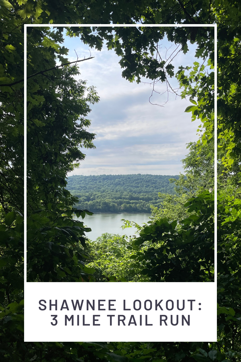
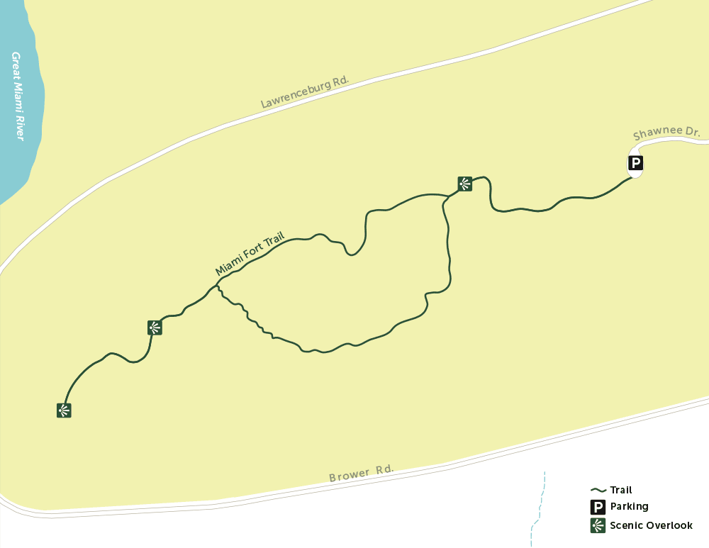
- 1.4 Mile Miami Fort Trail (my personal favorite for a casual stroll!)
There are also a newer group of trails that include the Cart Path Trails! This is 4.3 of former golf cart paths for multipurpose use.
Location:
Located on the Westside of Cincy along the Great Miami River with views of the Ohio River, too.
Map Directions:
We meet at the parking lot at the Blue Jacket Trailhead.
The Shawnee Lookout park entrance is located at 2008 Lawrenceburg Road, North Bend, OH 45052 [link to Maps].

Keep driving along the Shawnee Lookout Park Rd until you reach the parking lot at the Blue Jacket Trailhead and Little Turtle Trailhead.

Distance:
This run combines the Blue Jacket and Little Turtle for a combined total of 3.3 miles since their trailheads both begin at the same parking lot.
At the parking lot there’s a conveniently located bathroom and water fountain you can stop at between trails.

The Miami Fort Trail is far enough away from these two trails it’s worth driving to rather than walking or running.
Park Details:
This is a Hamilton County Park, so you’ll need a Great Parks pass to get in. (The passes are a great deal: $10 for entry into all Cincinnati parks for the entire year!)
Check out the Great Parks website for more park details.
Dogs are allowed on leash.
Read this snippet from 60 Hikes Within 60 Miles: Cincinnati posted by the Cincinnati Children’s Hospital blog for a more in-depth history of the area.
After The Run Recommendations:
The Incline Public House in East Price Hill has some of the best views of downtown Cincinnati [link to Maps].


Trail Maps:


Additional Images
See images of the Little Turtle and Blue Jacket trails, followed by the school house and log cabin, finishing with my favorite scenic spot: the Miami Fort trail.
Trail Run


Stone School House
This was once built near a spring so it could serve dual purposes. It was a schoolhouse above and a cool storage room below where water was stored and barrels of milk were kept from becoming spoiled!


Log Cabin
The historic cabin is a rare sight to see with its dovetail corner joints. It was originally built in 1795 in nearby Elizabethtown, Ohio by the Dunns, early settlers and direct descendants of a revolutionary war soldier. It was inhabited until the 1950’s, then in the 1970’s it was donated and moved to its current location in Shawnee Lookout.
Sadly, the costs of maintaining the log cabin to public safety standards outweigh it’s preservation for the Greak Parks. According to the Great Parks website, they are planning to tear down the building by the end of summer in 2024. So be sure to visit while you still can!


Miami Fort Trail


Additional Resources
You might also be interested in:
- Cincinnati Trail Running: Easy Hikes 3 to 6 Miles Long
- Trail Race Running 101: A Fleet Feet Dirt Days Review
- East Fork Lake: 5.6 Mile Backpack Trail Run
- Basic Trail Running Gear
- 5 Best Cincinnati Pumpkin Patches and Fall Festivals
- Savings that makes you money: High Yield Savings Account (HYSA)
- Easy and Versatile Aioli Recipe: ‘Marie’s Joy Mayo’… homemade in a blender!
2 responses to “Shawnee Lookout: 3 Mile Trail Run”
Wow.. These trails look amazing! I would love to check them out when I go to the US. I usually go hiking here in Stockholm. Nature and it’s trails are beautiful. Thank you for this excellent post <3 <3 <3
Great article filled with usedfull information! It is so interesting to read about the history of the log cabin and how it was move to its current location.